

Sign up for the Design News Daily newsletter.
Here Technologies Maps are Key to Mercedes Level 3 Automation
The background information provided by Here Technologies maps helps the Mercedes-Benz EQS Drive Pilot system understand the world where it drives.
4 Min Read
.jpg")
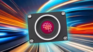
Mapping data on the Mercedes-Benz EQS is provided by Here Technologies.Image courtesy of Mercedes-Benz
The Mercedes Benz EQS is the world’s first vehicle with SAE Level 3 driver assistance, an accomplishment that is possible in part because of the car’s ability to precisely locate itself in the world and to understand the meaning of that location.
The dual rooftop GPS receivers let the car’s Drive Pilot system locate itself with 1 centimeter of accuracy, so the next step is the car understanding its surroundings now that it knows exactly where it is.
Here Technologies is providing the map data that ensures the EQS understands the world around it. It is important for the car to know where the roads are and what the characteristics of those roads are, such as the number of lanes and their speed limits. Map data also informs cars about things that are beyond its sensors, letting it “see around corners” to know about crashes, lane closures, or other issues ahead.
“This reimaged map is the core enabling data set for the 21st century,” states Here’s promotional material. It is easy to see why this is the case. The Here HD Live Map consists of multiple layers providing information for a car to know where exactly it is and what lies ahead. This lets vehicles proactively adjust to changing road conditions like adjusting its speed ahead of an upcoming lane closure.
This is important for the Drive Pilot system’s dependability, according to Mercedes-Benz vice president for automated driving, Georges Massing. “In combination with extensive sensor data, Drive Pilot receives information about the road geometry, route profile, traffic signs and unusual traffic events such as accidents or roadworks from a digital HD map, which is one key element for automated driving,” he explained. “Its ultra-precise positioning system goes well beyond the usual GPS system.”
Here’s partnership with Mercedes dates back to the companies’ 2013 collaboration on the S 500 Intelligent Drive research project, which saw the Mercedes S-Class successfully navigate the historic Bertha Benz memorial route for that year’s Frankfurt Motor Show.
Here’s capabilities in this area are why Counterpoint Research has named the company as the leading location platform in the world for five straight years. It topped familiar brands such as Google and Tom Tom to earn that spot, with Countpoint citing how Here, in the last 18 months, has expanded its portfolio, platform capabilities partnerships, and customer base “to widen the gap with rivals.”
“Here Platform has thus evolved into an industry-first and one-stop platform with infrastructure and toolsets for companies to develop, license, and integrate first and third-party mapping, location intelligence data into their applications at scale,” remarked Counterpoint’s research vice president, Neil Shah.
Philip Hubertus, senior manager, product management of automated driving maps at Here, points to three primary attributes that make Here’s maps successful for systems like Drive Pilot. They are the Road Model, the Lane Model, and the Cluster in Here’s HD Live Map.
“The road model is the standard map data such as the country, road type, road geometry, speed limits, et cetera,” he said. “You know where you are and you have cameras, but that still doesn’t tell you exactly what the road rules and regulations are.”
.gif")
Next is the Lane Model, which provides more precise detail. “It includes what’s around you and how you can allow the vehicle to behave,” said Hubertus. “For example, lane changes, what to expect ahead, mergers, on-ramps, off-ramps, lane markings, and boundaries. It helps you position the vehicle inside those lanes and understand if those lanes are drivable or are something like a shoulder or a bus lane.”
The third component serves to double-check the vehicle’s location by watching for landmarks alongside the road and comparing them to their recorded location on the map. “It includes things like poles, barriers, and objects along the road,” he said. “That helps you position yourself along the road.”
This is particularly crucial when the GPS signal is unreliable, such as in urban canyons and tunnels. This is not only important for helping the car know where it is, it also assists the car’s computer in identifying what its sensors are seeing to minimize mistakes. “It can tell that an object is an overhead sign [from the map], not a truck doing a left turn,” Hubertus explained.
Another Here customer in the trucking industry is able to exploit Here’s HD map to help its driver rely more continuously on their automation system that controls their trucks’ engines, transmissions, braking, and speed, while the driver is responsible for the steering. The system saves the trucking company 10 percent on fuel costs, so Here’s ability to help drivers keep the system engaged as much as possible saves that company money. “Want driver to be able to rely on this and use this,” Hubertus said.
Indeed, that is the goal for consumers’ use of automated driving assistance systems too, so Here’s sophisticated maps will help drivers enjoy using these systems rather than disengaging them from frustration.
About the Author(s)
You May Also Like
Editors' Choice


Jun 4 - Jun 6, 2024
Jun 4 - Jun 6, 2024
Innovation in automation starts here. Discover and collaborate on automation solutions that are revolutionizing the entire production lifecycle — from design to production to market — and sharpen your competitive edge. ATX South is part of IME South, a six-in-one expo offering the latest insights & solutions spanning medtech, packaging, automation, plastics, design, & processing.
Register Now