

Sign up for the Design News Daily newsletter.
By sharing data from its cars, Honda can provide drivers, other road users, and road operators with important safety information.
3 Min Read

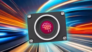
Honda's head-up display alert for snowing conditions ahead.Image courtesy of Honda
In anticipation of the Intelligent Transportation Systems World Congress, Honda Motor Co. is showcasing its efforts to provide drivers, vehicles, and highway maintainers with real-time information about road conditions.
The Honda Sensing 360 suite surveys the area around vehicles in an effort to eliminate blind spots. The aim is to avoid collisions with pedestrians and other vehicles while also easing the driver’s burden.
Honda began installing Honda Sensing 360 on its vehicles with the 2015 Honda CR-V and under the brand AcuraWatch for the 2015 Acura TLX and now has six million cars on the road in the U.S. that are equipped with these sensors. The company says that Honda Sensing 360 is standard on its cars sold in China starting this year and will be standard across its Honda and Acura U.S. product lines by 2030.
The technologies employed adds omnidirectional sensory range from five advanced millimeter-wave radar units around the vehicle, in conjunction with the existing monocular camera used by the current Honda Sensing systems.
"Honda Sensing 360 represents the next major step in what has already been an industry-leading application of safety and driver-assistive technologies," said Gary Robinson, assistant vice president of Product Planning at American Honda Motor Co., Inc. "Honda will continue to advance our technologies to improve safety for everyone sharing the road and play a leading role in realizing a collision-free society."
In addition to looking for pedestrians and other vehicles, Honda also wants its cars to study the road itself through its Road Hazard Monitoring System. The company is piloting this system using its advanced driver-assistance system (ADAS) cameras to detect hazardous road conditions such as potholes and construction zones and provide alerts to drivers and motorcyclists in the vicinity. The goal is to enhance the safety of road users by calling attention to potential road hazards before vehicles pass through the area.
The system is developed by the Honda Research Institute and it looks at things like the condition of lane markings and weather conditions. For the lane markings, it provides a classification of green for “ideal” to red for “needs repair.”

The system visually classifies lane lines to the left and right of the vehicle using four color codes: green, yellow, gray, and red. Green and yellow classifications respectively indicate ideal-to-good lane marking conditions. Gray classifications are for when there are no lane lines and red indicates that the lane markings need repair.
That road condition information, including longitude and latitude coordinates along with relevant images and video clips, is captured by the vehicle, anonymized, and then streamed to a secure platform for analysis. Road operators can access this platform to identify the location, type, and severity of the road condition and hazard information, and obtain a still image and video. The pilot program in Ohio shares this information with road operators at the Ohio Department of Transportation.
“Maintaining good road conditions helps keep everyone sharing the road safe,” said Paritosh Kelkar, a scientist at Honda Research Institute USA, Inc. and project leader of the road condition monitoring system. “Real-time, high-accuracy roadway data captured from connected vehicles has the potential to improve the process of identifying, reporting, and more quickly repairing hazardous road conditions.”
In addition to data collected about the environment around the car, Honda can also exploit data from cars themselves. The Honda Drive Data Service can look at hard braking events and correlate this to identify dangerous locations where there may be more collisions. Knowing this can help road operators understand the need to improve the infrastructure in those locations.
About the Author(s)
You May Also Like
Editors' Choice


Jun 4 - Jun 6, 2024
Jun 4 - Jun 6, 2024
Innovation in automation starts here. Discover and collaborate on automation solutions that are revolutionizing the entire production lifecycle — from design to production to market — and sharpen your competitive edge. ATX South is part of IME South, a six-in-one expo offering the latest insights & solutions spanning medtech, packaging, automation, plastics, design, & processing.
Register Now